To reach to Paraguay's major cities from the Atlantic Ocean, vessels must pass through nearly 1,500 kilometers of Argentine territory. Paraguay's river systems also connect the country with Bolivia and the Pacific Ocean as well as with Brazil, its largest trading partner. From the late 1880s, river transportation in Paraguay was dominated by Argentine and Brazilian shipping companies.
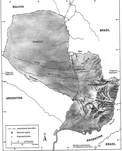
The Río Paraná and Río Paraguay are the country's two main waterways (see fig. 3). The Río Paraguay, with headwaters at Mato Grosso, Brazil, flows southward, converging with the Paraná in southwestern Paraguay, and then flowing to the Río de la Plata Estuary, the entrance for the great majority of ships servicing Paraguay's ports. Vessels over 5,000 tons cartravel upriver only as far as Asunción during the winter months (March to October). The Río Paraná, 4,500 kilometers in length, is one of the world's major rivers and the primary mode of transportation along Paraguay's eastern and southern borders. Also flowing southward, the Paraná throughout the 1980s up was only navigable for most ships to the port of Encarnación. The construction of the Yacyretá hydroelectric plant, however, was expected to raise the water levels at Encarnación, allowing ocean-going vessels to venture as far north as Puerto Presidente Stroessner.
As a result of the rapid growth in road construction since the 1970s, the transportation role of smaller rivers was declining, especially in terms of international trade. Still, these river systems comprised over 3,000 kilometers of inland waterways.
The port of Asunción was the nation's only truly modern port and handled most of the country's imports and exports (see fig. 7). Asunción sported modern berthing facilities and advanced cargohandling equipment. Originally privately owned, the port was purchased by the government in 1940 and was managed by the Ministry of Public Works and Communications through the National Port Authority. In the 1980s, the government was striving to expand and upgrade the port's highly congested facilities. Because of congestion at Asunción, the government also was planning to build a new port thirty-seven kilometers south of the capital at Villeta. Asunción's future role as a port would be primarily to receive imports. In the late 1980s, Villeta already was handling a greater share of the country's agricultural and industrial exports. The fastest growing hub of commercial activity, however, was located at the port city of Puerto Presidente Stroessner, where Paraguay was connected with Brazil by the spectacular single-span Friendship Bridge. This growing city was also the site of the country's new international airport and generally served as the major way station for contraband trade. The country's other ports were generally small and less modern than Asunción; they included San Antonio, Encarnación, Concepción, Casado, Villa Elisa, Bahía Negra, Sajonia, Calera Cué, and Vallemí.
The government's Merchant Marine (Flota Mercante del Estado-- Flomeres) handled approximately 25 percent of the country's annual cargo level. Although many of the country's ships were outdated, in the 1980s Flomeres purchased more modern ships from Japan through government financing from that nation. Paraguay also had a privatesector fleet of merchant ships and numerous small shipping enterprises. Argentine, Brazilian, Dutch, British, and American companies provided the balance of shipping services.
Data as of December 1988