Most of Uruguay is a gently rolling plain that represents a transition from the almost featureless Argentine pampas to the hilly uplands of southern Brazil. The country itself has flat plains on its eastern, southern, and western edges. The narrow Atlantic coastal plain is sandy and marshy, occasionally broken by shallow lagoons. The littorals of the Río de la Plata and the Río Uruguay are somewhat broader and merge more gradually into the hilly interior (see fig. 3).
The remaining three-quarters of the country is a rolling plateau marked by ranges of low hills that become more prominent in the north as they merge into the highlands of southern Brazil. Even these hilly areas are remarkably featureless, however, and elevations seldom exceed 200 meters.
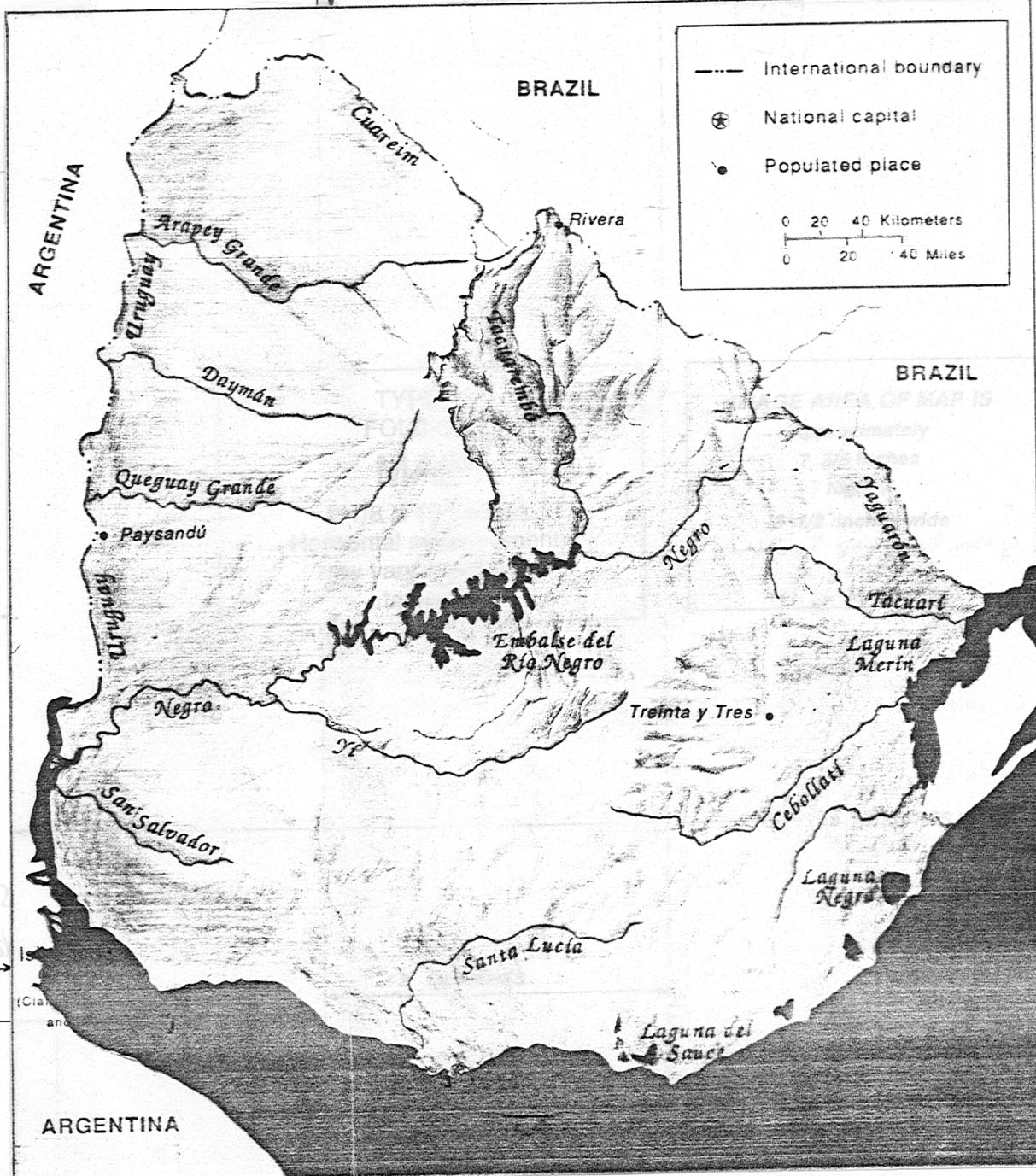
Uruguay is a water-rich land. Prominent bodies of water mark its limits on the east, south, and west, and even most of the boundary with Brazil follows small rivers. Lakes and lagoons are numerous, and a high water table makes digging wells easy.
Three systems of rivers drain the land: rivers flow westward to the Río Uruguay, eastward to the Atlantic or tidal lagoons bordering the ocean, and south to the Río de la Plata. The Río Uruguay, which forms the border with Argentina, is flanked by low banks, and disastrous floods sometimes inundate large areas. The longest and most important of the rivers draining westward is the Río Negro, which crosses the entire country from northeast to west before emptying into the Río Uruguay. A dam on the Río Negro at Paso de los Toros has created a reservoir--the Embalse del Río Negro--that is the largest artificial lake in South America. The Río Negro's principal tributary and the country's second most important river is the Río Yí.
The rivers flowing east to the Atlantic are generally shallower and have more variable flow than the other rivers. Many empty into lagoons in the coastal plain. The largest coastal lagoon, Laguna Merín, forms part of the border with Brazil. A half-dozen smaller lagoons, some freshwater and some brackish, line the coast farther south.
Data as of December 1990